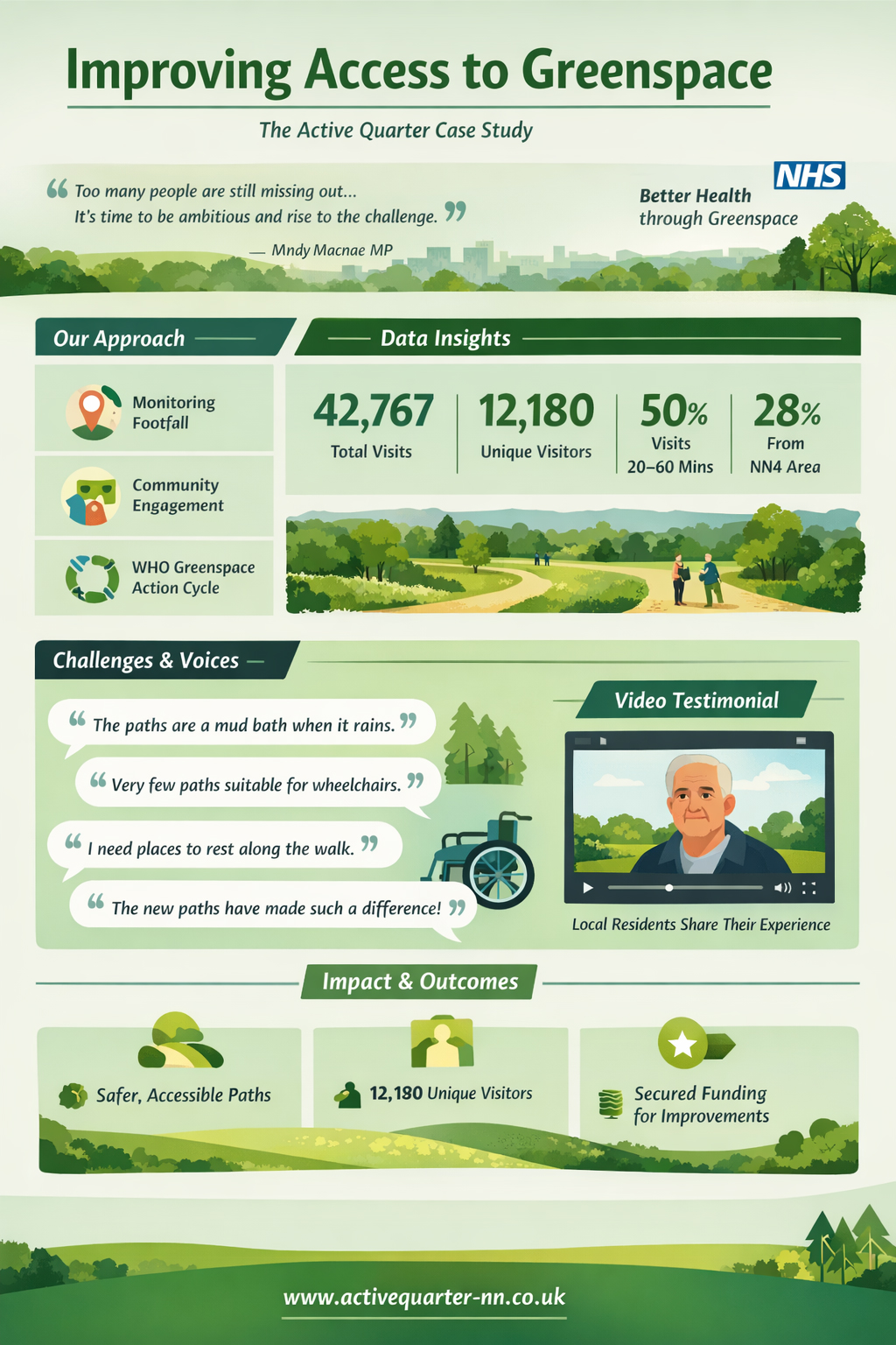
For over 70 years, access legislation has helped improve where we can go and what we can do outdoors. Yet, as highlighted by Andy Macnae MP, too many people are still missing out, at a time when government policy is increasingly focused on prevention, active lifestyles, and access to nature. This case study explores how the Active Quarter project is combining data, lived experience, and innovative digital tools to better understand how people use greenspace, and how those spaces can be improved for everyone.
Understanding the Challenge
Access to greenspace is not simply about location, it’s about usability, confidence, and inclusion. Frameworks such as Natural England’s Green Infrastructure Framework emphasise partnership working and long-term planning. However, there is often a gap between strategy and lived reality. Many decision-makers lack clear insight into how people actually experience parks and green spaces on the ground. Without that understanding, it becomes difficult to design spaces that truly meet people’s needs, or to justify investment in improving them.
A Data-Driven Approach
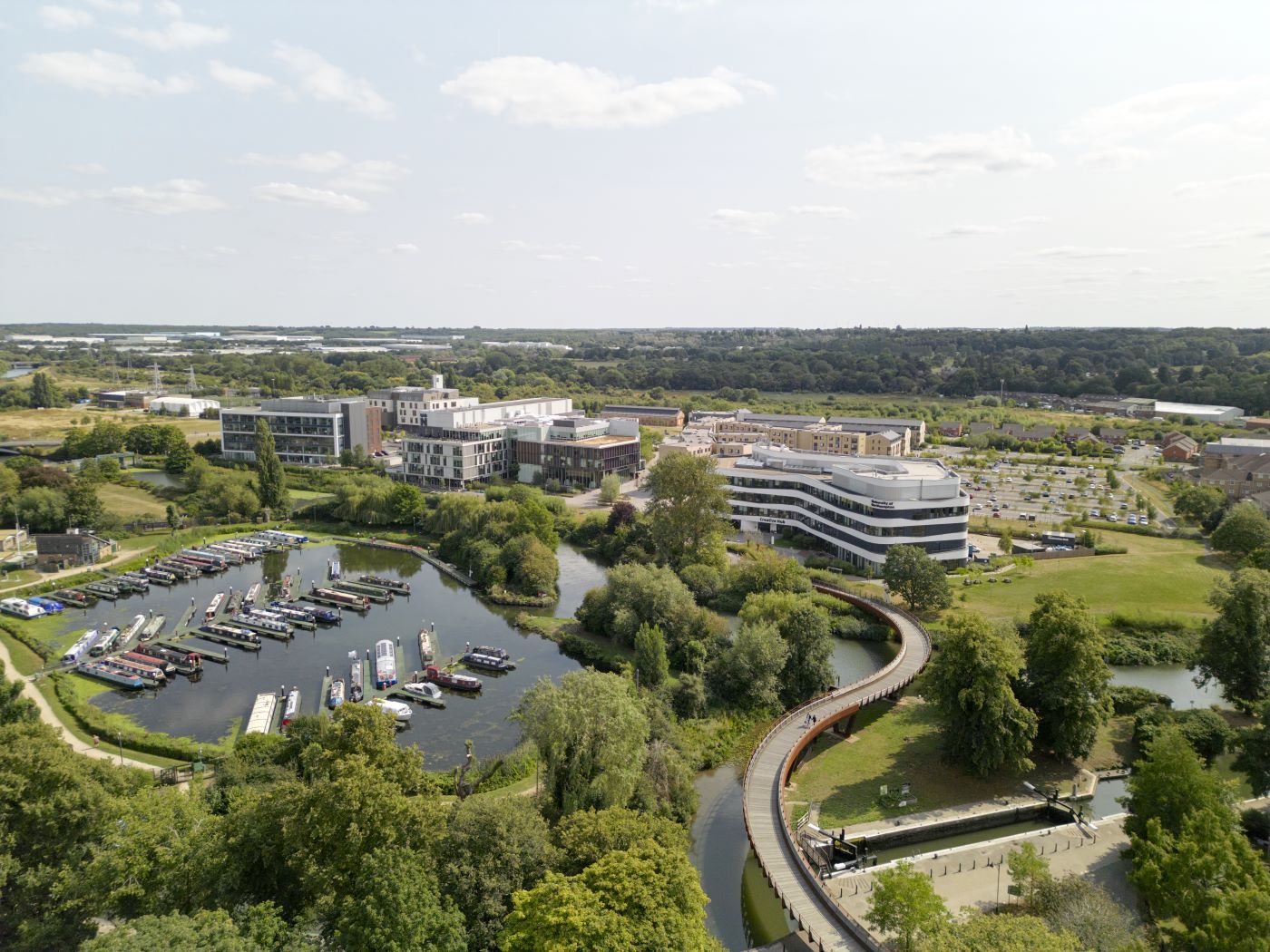
The Active Quarter initiative set out to address this gap by strengthening how greenspace use is monitored and understood. Footfall monitoring has provided valuable insight into how spaces are used. For example, data collected at Delapré Park showed:
- 42,767 total visits
- 12,180 unique visitors
- 50% of visits lasting between 20–60 minutes
- A strong proportion of visitors coming from the local NN4 area (28%)
This type of data is essential for local authorities, who must demonstrate value for money when applying for funding. Monitoring data has already been used to support funding bids, helping to unlock investment in greenspace improvements.
Bringing Data to Life: Mapping Access with 360° Technology
While data tells us how many people visit a space, it doesn’t show what those spaces are actually like to navigate. To address this, the project has introduced an innovative approach: using 360° camera technology to map footpaths and routes within parks. By walking routes with a 360 camera, the project captures immersive, street-level footage of real conditions—surfaces, gradients, widths, and potential barriers. These recordings are then uploaded to platforms such as Google Street View, making them accessible to the public.
This transforms how people can engage with greenspaces before they even arrive.
Instead of relying on abstract maps, users can:
- Visually assess path quality and terrain
- Identify barriers such as steps, mud, or uneven surfaces
- Decide whether a route suits their mobility needs
For individuals with mobility challenges, long-term health conditions, or low confidence in unfamiliar environments, this is a powerful tool. It allows people to preview a space, reducing uncertainty and enabling more informed choices. For planners and stakeholders, the impact is equally significant. The footage creates a clear, visual record of accessibility challenges making it easier to understand issues and justify improvements. In this way, 360° mapping bridges the gap between data and lived experience, offering a more complete and human understanding of access.
More Than Numbers: Listening to Lived Experience
Data and digital tools are only part of the story. Understanding how people feel about these spaces is just as important.
Community voices reveal barriers that are often invisible in datasets:
- “The paths are dangerous when the weather has been wet.”
- “When it rains, they are a complete mud bath.”
- “Very few pathways are suitable for wheelchair use or cycling.”
These insights highlight how environmental conditions can significantly limit access. For some, improved infrastructure has already made a difference:
- “I wouldn’t come if the weather hadn’t been great… but now I come regularly because the paths have made such a difference.”
For others, accessibility is deeply personal:
- “I’ve got arthritis… having proper paths gives you confidence in walking.”
Designing for Inclusion
Creating accessible greenspaces requires attention to detail. Simple features, such as seating, can dramatically change how people use a space:
- “If I knew I could sit down halfway, I would do the walk more often.”
In some locations, there can be over 1,300 metres between resting points. For individuals with mobility challenges, this distance can be a significant barrier.
These insights reinforce the need to design spaces that are not only available, but usable and welcoming for all.
From Insight to Impact
By combining quantitative data, immersive digital tools, and lived experience, the Active Quarter project is supporting meaningful change.
Monitoring data has helped strengthen funding applications. Community feedback ensures that improvements reflect real needs. Meanwhile, 360° mapping provides a powerful visual tool to communicate both challenges and progress.
Together, these approaches create a more complete evidence base—one that is both measurable and human.
Building Better Relationships
A key lesson from this work is the importance of trust and communication.
Communities often report feeling disconnected from research processes, particularly when feedback is collected but outcomes are not shared. This can lead to frustration and disengagement.
To create lasting impact, it is essential to:
- Share findings openly
- Demonstrate how feedback leads to change
- Build ongoing relationships with communities
Looking Ahead
Improving access to greenspace requires more than policy, more than data, and more than design it requires listening, innovation, and collaboration. By combining data with lived experience, and by embracing tools such as 360° mapping, we can build a richer understanding of how people interact with the spaces around them. The challenge now is to continue this work ensuring that greenspaces are not only available, but truly accessible, inclusive, and meaningful for everyone.
Find out more about the Active Quarter (Powerpoint).
